Graphic History
A Visual History of Calle Gil de Santivañes
1656: Map of Madrid by Pedro de Teixeira.
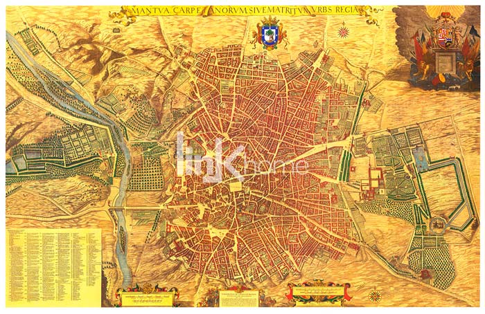
Photo: To the right, the fields of Recoletos before the Villa Nueva district was built. 1656.
Below, an extract of the area surrounding today’s calle Gil de Santivañes
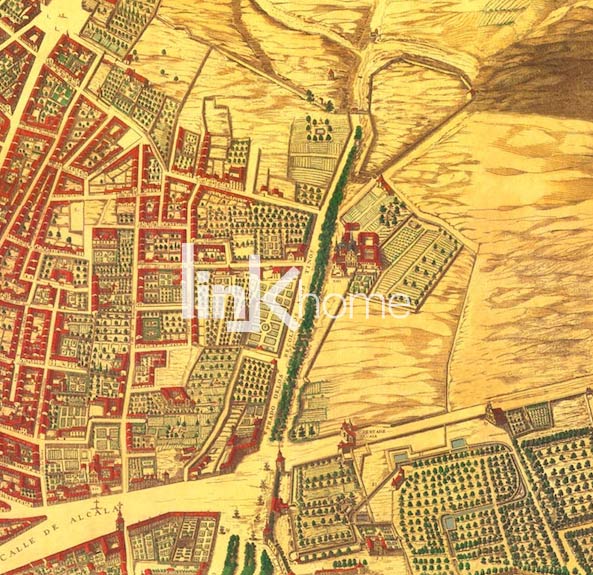
Photo: Extract taken from Pedro Teixeira’s map, where we can see the area surrounding today’s Calle Gil de Santivañes. It was originally located between the Convento de los Agustinos Recoletos to the north, the Paseo de Recoletos to the west, the Puerta de Alcalá to the south and orchards and fields to the east.
End of 17th Century
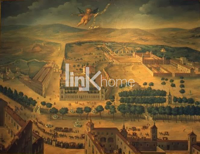
Photo: Painting of the Prado de San Jerónimo meadow. Anon. Dating back to the end of 17th century. In the far left of the picture, the Convento de los Agustinos Recoletos can be seen. Together with the junction between Paseo de Recoletos / Camino de Alcalá, this marks the current location of calle Villanueva.
1706
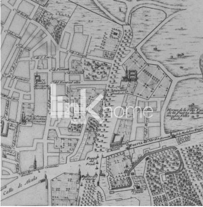
Photo: Extract from Nicolás de Fer’s 1706 map. The Villa Nueva district already figures on this map, although the street, as happens with calle Gil de Santivañes, may not have been formed yet and in later maps it does not appear. It may be that Villa Nueva here refers to the Villa Nueva district, a bakers’ district. The map includes the Madrid coat of arms and a text in French, which lists the city’s virtues…. and tells us, French courtesy..., how filthy it was.
1785
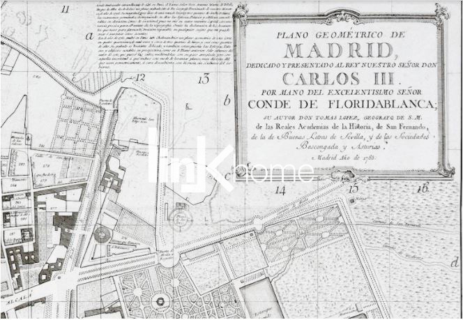
Photo: Extract from Tomás López’s 1785 geometric map. The Recoletos gardens, with the Convento de los Agustinos Recoletos to the west and the Real Pósito land to the south, would go on to become the block that is today lined by calle Gil de Santivañes, Villanueva and Recoletos.
1848
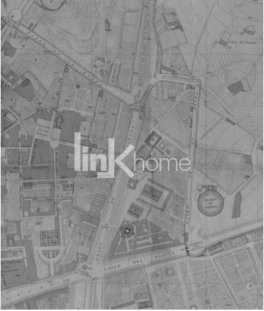
Photo: Extract from the map engraved in 1848 by Juan Noguera. Today’s calle Gil de Santivañes is traced between the buildings of the Faculty of Veterinary Science (land which is today occupied by the National Library) and the carriage factory. Present-day Calle Serrano, then called Calle de Ronda, separated the district from the Alcalá bullring.
1861 – Expansion of Madrid (Castro Map)
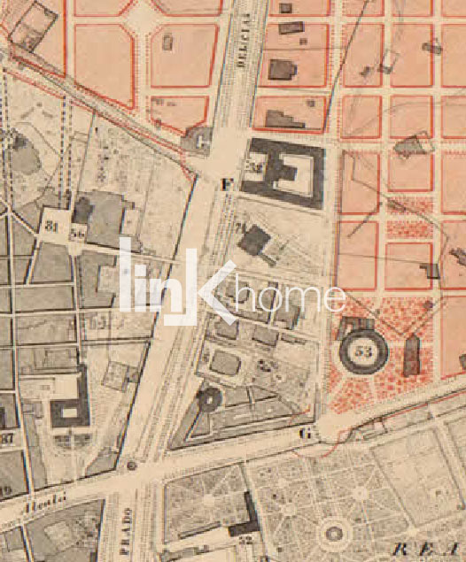
Photo: Extract from the general map of the Expansion of Madrid by Carlos María de Castro with the Calle Gil de Santivañes not yet sketched out.
1870
Stamp of the 1870 plot map, an extract of which is included below showing the block of the current no. 5 calle Gil de Santivañes.
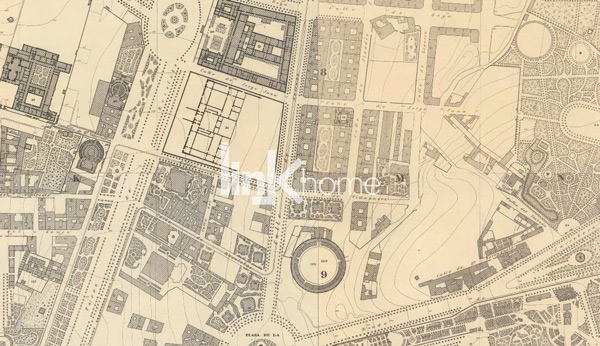
Photo: Extract from the 1870-1874 plot map, with the calle Serrano marked out, as well as calle Recoletos, calle Cid and calle Villanueva,with calle Gil de Santivañes still to appear. On the block immediately to the north we see the superimposed map of the National Library and Archaeological Museum, the building of which began in 1866 but did not conclude until 25 years later. There are still no buildings located on the site of the current no. 5 of Calle Gil de Santivañes.
Present day vs. 1831
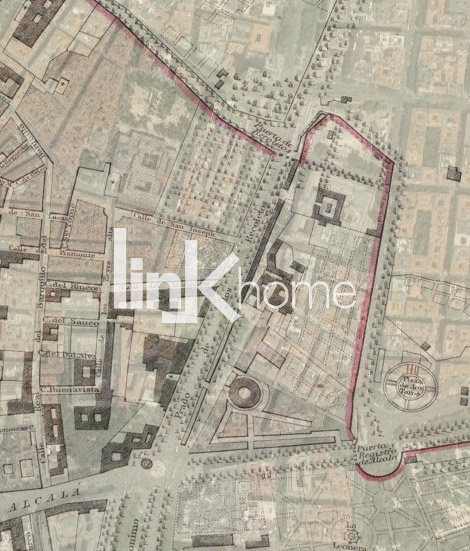
Photo: Current aerial photo superimposed on Bladwin & Dradock’s 1831 map.
Current Location
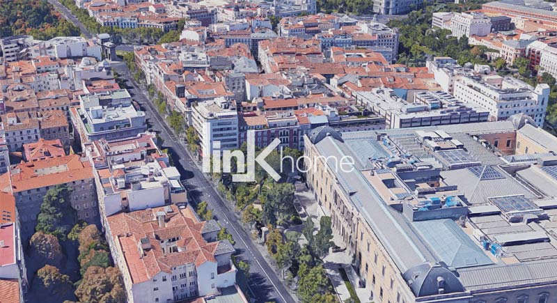
Photo: Aerial view of the area surrounding the calle Gil de Santivañes today.